Share Maroubra Bay Flood Study on FacebookShare Maroubra Bay Flood Study on TwitterShare Maroubra Bay Flood Study on LinkedinEmail Maroubra Bay Flood Study link
Consultation has concluded
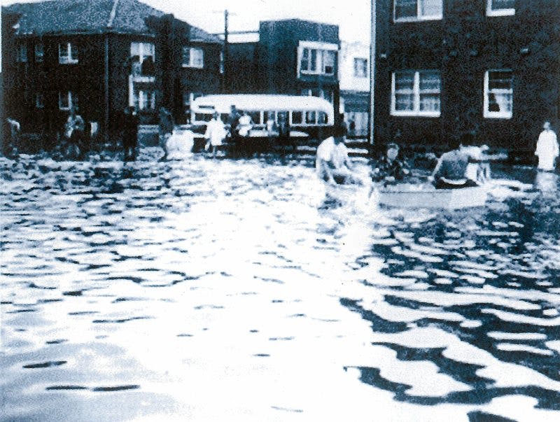
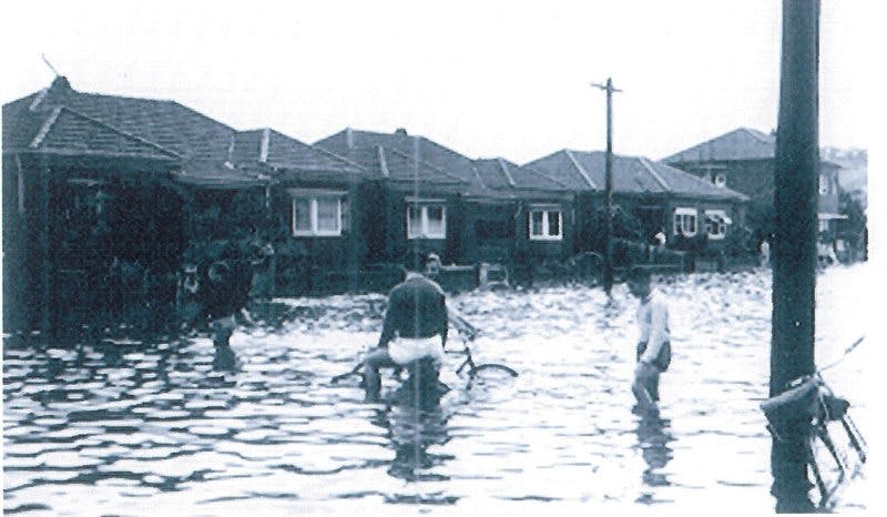
There has been a number of floods in the Maroubra Bay catchment in the past and the two most memorable floods were in 1959 and 1999. There have also been a number of smaller floods over the years.
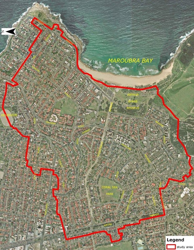
Randwick Council has prepared a Draft Maroubra Bay Flood Study for the catchment that drains towards Maroubra Bay, between Anzac Parade and the Pacific Ocean - an area of approximately two and a half square kilometres.
This Draft Flood Study sets out the frequency and severity of flooding in the study area, using historical and technical information. The Study gives residents the information they need to prepare for floods and gives Council the information it needs for future planning.
We would like to hear about flood experiences in the area and your comments on the Flood Study.
Please review the documents in the library including the flood study maps, flood study fact sheet, the flood study documents and have your say in the Flood Study Forum below..
There has been a number of floods in the Maroubra Bay catchment in the past and the two most memorable floods were in 1959 and 1999. There have also been a number of smaller floods over the years.
Randwick Council has prepared a Draft Maroubra Bay Flood Study for the catchment that drains towards Maroubra Bay, between Anzac Parade and the Pacific Ocean - an area of approximately two and a half square kilometres.
This Draft Flood Study sets out the frequency and severity of flooding in the study area, using historical and technical information. The Study gives residents the information they need to prepare for floods and gives Council the information it needs for future planning.
We would like to hear about flood experiences in the area and your comments on the Flood Study.
Please review the documents in the library including the flood study maps, flood study fact sheet, the flood study documents and have your say in the Flood Study Forum below..
Share Do you have any comments on the Maroubra Flood Study? on FacebookShare Do you have any comments on the Maroubra Flood Study? on TwitterShare Do you have any comments on the Maroubra Flood Study? on LinkedinEmail Do you have any comments on the Maroubra Flood Study? link
Share How were you affected by flooding in Maroubra? on FacebookShare How were you affected by flooding in Maroubra? on TwitterShare How were you affected by flooding in Maroubra? on LinkedinEmail How were you affected by flooding in Maroubra? link
Share What have been your experiences of flooding in Maroubra? on FacebookShare What have been your experiences of flooding in Maroubra? on TwitterShare What have been your experiences of flooding in Maroubra? on LinkedinEmail What have been your experiences of flooding in Maroubra? link